
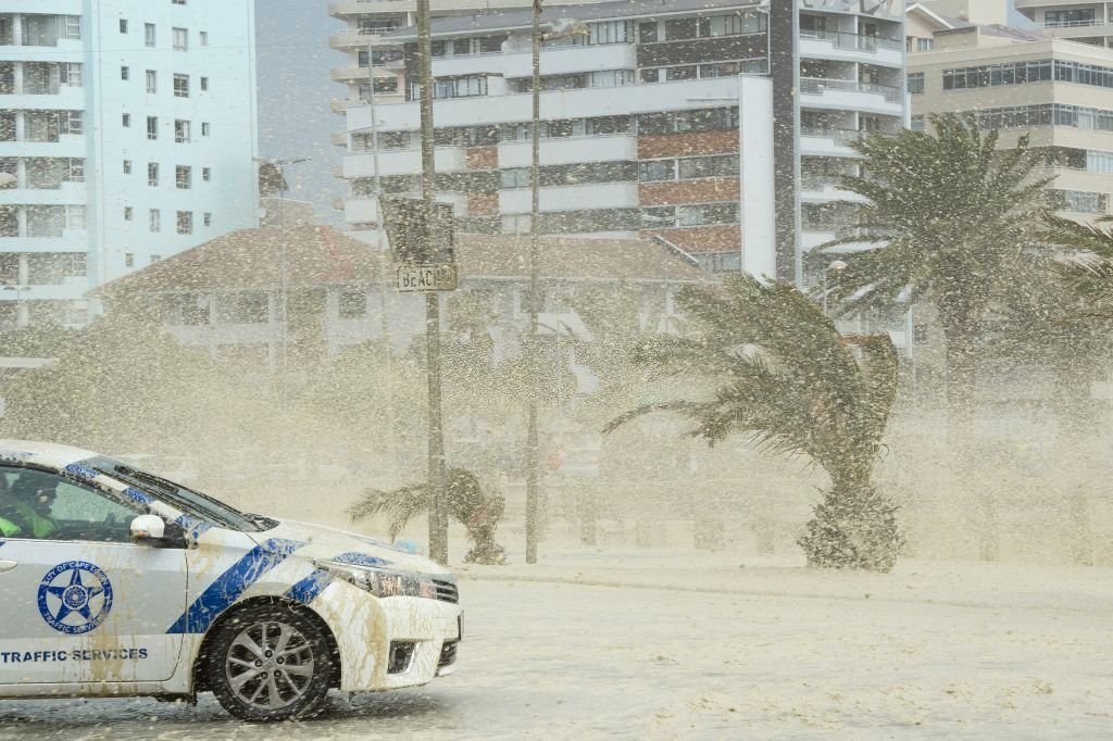
The South African Weather Service has sounded the alarm for potential disruptive rain and strong winds set to impact regions of the Western and Eastern Capes. The alerts are scheduled to commence this afternoon, extending into the weekend. The entirety of the Garden Route is under scrutiny, with officials from the Western Cape expressing heightened preparedness. Towns including Knysna, George, Mossel Bay, and Oudtshoorn on the Garden Route are receiving special attention due to their vulnerability. The recent devastating tidal waves in the Eastern Cape, which resulted in fatalities, have heightened concerns for maritime activities and those commuting along the Garden Route.
Mpho Rasimphi, a seasoned meteorologist, stated, “The exact intensity of the current situation is hard to pinpoint. We’re observing another ‘cut-off low’ weather pattern, similar to previous ones that have affected South Africa.”
This cut-off low is positioned over the Northern Cape’s interior, creating a depression that extends to the ground. This system predominantly impacts the Northern Cape, the whole of the Western Cape, and the Eastern Cape, intensifying as it approaches the coastlines. The alert level has been escalated to 9, signifying potential inundation across the coastal belts of both the Western and Eastern Capes.
Safety Measures and Precautions
For those in the affected regions, the advice is clear: in the event of flooding, move to elevated areas. The impending deluge could manifest as either widespread or sudden flash floods, covering vast territories. Additionally, residents should brace for powerful winds, with velocities reaching up to 80 km/h and gusts surging to 100 km/h. The safest course of action is to remain indoors and ensure properties are fortified against these gusty conditions.
The cut-off low, a previously discussed meteorological event, is notoriously difficult to forecast in terms of its exact strength. It’s projected to intensify today, with the warnings in effect for both the current day and the next. By tomorrow evening, the weather system is expected to start receding. However, as always with weather, there’s an element of unpredictability. Current projections indicate that by Tuesday, this system will start to wane, reverting to an upper trough and gradually dissipating as the week unfolds.
Regions on Alert
Inhabitants of the Eastern and Western Capes are urged to exercise heightened caution. The Western Cape’s warning level stands at 9, while the Eastern Cape’s is at 8. The southern sections of the Northern Cape, select regions of the Free State, and portions of KwaZulu-Natal are also on the watchlist. Furthermore, areas in Mpumalanga, the Free State, and the Northwest are on a level 2 alert for the upcoming day.